Multi-platform LiDAR and photogrammetric acquisition services
Sixense’s Helimap service delivers high-resolution helicopter-based LiDAR and aerial imaging surveys, providing precise and comprehensive data coverage for large or complex project environments. Designed to support infrastructure development, asset management, and environmental assessment, Helimap’s services enables teams to capture accurate topographic, structural, and terrain information rapidly, even in challenging, remote, or inaccessible areas. The result is a reliable, detailed digital representation of the real world that informs better planning, safer construction, and more effective long-term decision-making.
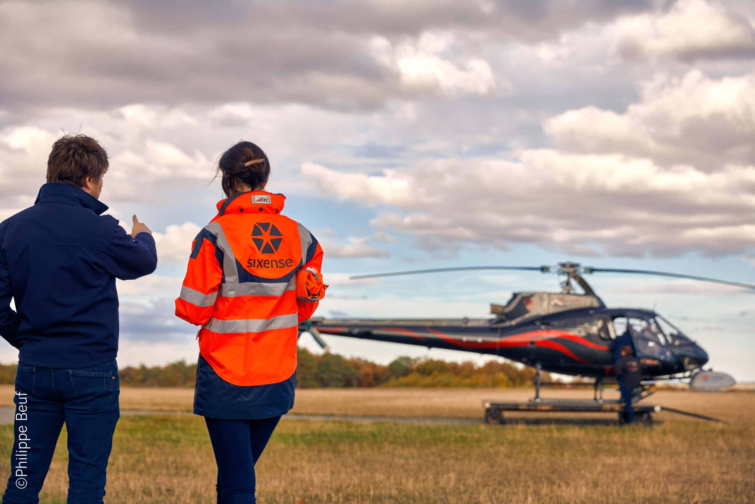
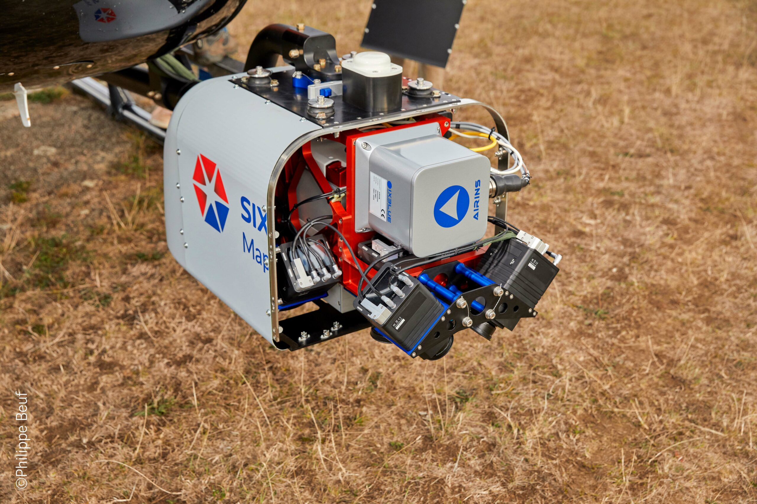
Using advanced LiDAR scanning technology mounted on helicopters, Sixense Helimap captures millions of survey-grade data points in each pass, producing highly detailed 3D point clouds and digital terrain models. This airborne approach allows for rapid surveying of long linear corridors such as railways, highways, transmission lines, pipelines, rivers, and coastline boundaries. Because the survey is conducted from the air, it avoids many of the safety and access risks associated with ground surveying, while significantly reducing operational and project disruption.
Sixense Helimap’s services also integrate aerial photography and high-resolution imaging with LiDAR datasets, allowing surface features to be visualised in context. This combined dataset supports accurate mapping of natural and built environments—including buildings, vegetation, utilities, and landforms—making it ideal for feasibility studies, route selection, environmental assessments, and engineering design. The resulting deliverables can be used directly in GIS, CAD, and BIM environments, ensuring seamless integration with client workflows.
The service is highly flexible and can be tailored to the specific needs of each project. Different flight altitudes and scan configurations can be used to optimise resolution, coverage, or data density. Sixense’s experienced aviation and survey teams plan and execute each mission carefully to account for terrain, weather, safety zones, and regulatory permissions. This ensures reliable, consistent, and accurate acquisition, even across sensitive or complex project environments.
Once captured, the data is processed using advanced modelling and quality control workflows to produce accurate terrain surfaces, contour models, asset maps, and 3D visualisations. Sixense’s specialists analyse the datasets and provide interpretation and reporting tailored to engineering, planning, or environmental requirements. The high precision and clarity of the data enable stakeholders to detect ground movement risks, optimise infrastructure design, monitor change over time, or assess asset conditions from a safe distance.
Helimap forms part of Sixense’s integrated digital services, allowing helicopter-acquired data to be combined with ground monitoring, InSAR satellite data, and geotechnical investigations. This integrated approach supports a complete understanding of the built and natural environment, enhancing project assurance and reducing risk. With Helimaps, Sixense delivers a powerful, efficient, and scalable solution for capturing the real world in exceptional detail—enabling informed decisions at every stage of the project lifecycle.
