Skip to content Transforming your infrastructure into living assets

Terrestrial LiDAR

Terrestrial LiDAR is a powerful technology used to capture high‑resolution, three‑dimensional representations of infrastructure, landscapes, and engineered assets.


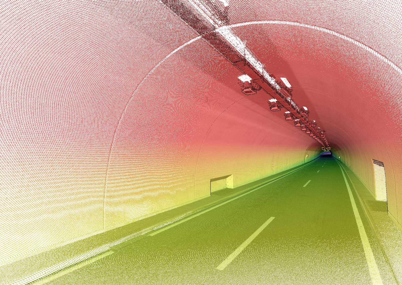
Using ground‑based laser scanning systems – either static or mobile – terrestrial LiDAR provides dense point‑cloud data that supports precise measurements, condition assessment, digital twin development, and engineering analysis. It is especially valuable in environments where high accuracy is required or where aerial surveys may be limited, such as tunnels, underpasses, bridges, industrial facilities, and confined or complex areas.
Sixense integrates terrestrial LiDAR within its broader digital acquisition offering, which includes LiDAR, scanning, and photogrammetric data collection from platforms such as vehicles, drones, helicopters, and static ground units.

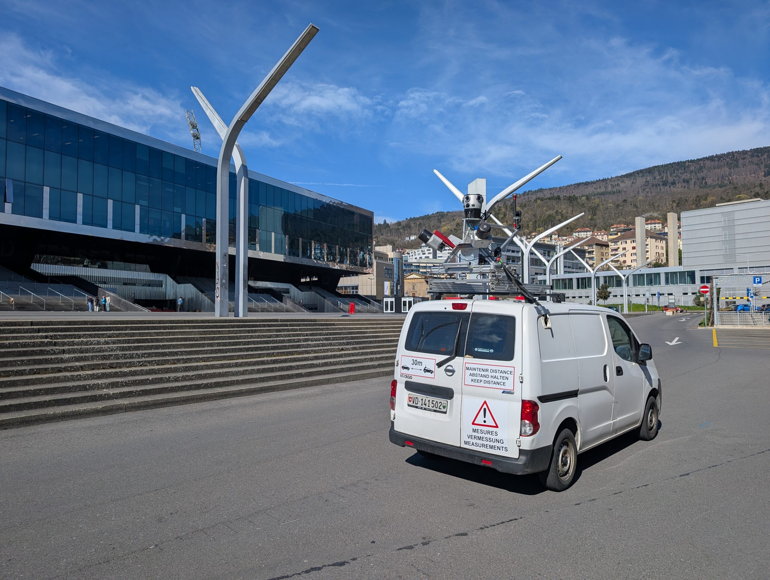
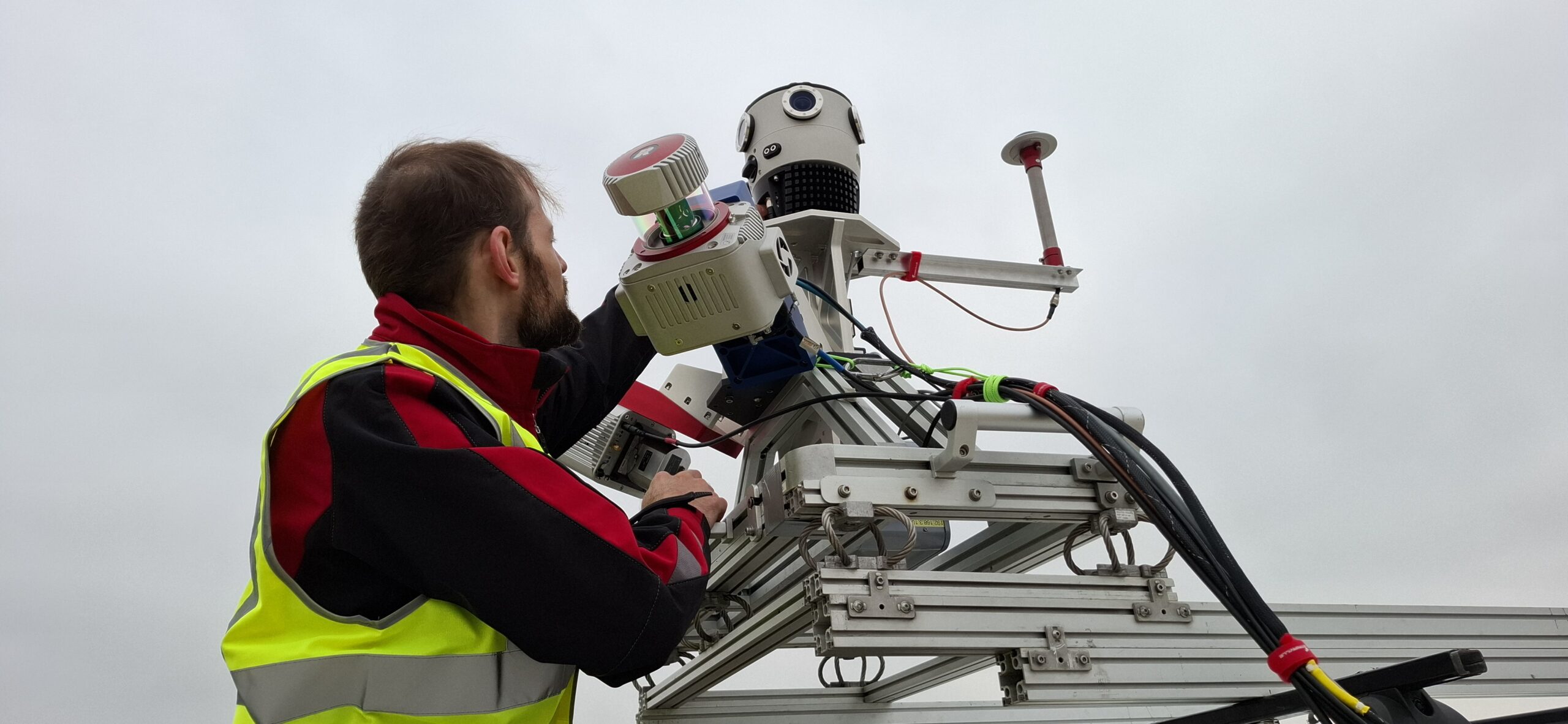
Sixense provides a comprehensive suite of terrestrial LiDAR services, including high‑density mobile mapping, static laser scanning, 3D surveys, and integration of LiDAR with imaging technologies for enhanced documentation and inspection. Our mobile mapping solutions allow rapid surveying of large or difficult‑to‑access areas using vehicle‑mounted LiDAR systems, delivering topographic accuracy and detailed digital inventories without disrupting operations.
These services support applications such as infrastructure monitoring, industrial asset documentation, urban environment mapping, metrological inspections, and heritage digitisation. Combined with their advanced data processing, classification, and segmentation tools, Sixense ensures that LiDAR outputs are delivered in formats optimised for engineering, construction, and asset management workflows.

Our experience in LiDAR acquisition is extensive, with more than 20 to 30 years of operational knowledge across our global team.

Sixense Helimap, a key part of the group, has been delivering LiDAR and photogrammetry services since 2005, with operations spanning across 50 countries and more than 1,000 completed projects, including terrestrial mobile LiDAR surveys.

Our systems have supported over 3,000 km of LiDAR‑based infrastructure surveys and thousands of kilometres of mobile mapping projects worldwide, demonstrating strong expertise in both terrestrial and aerial LiDAR deployment. With proprietary technologies, rapid mobilisation capability, and a multidisciplinary understanding of geospatial acquisition, Sixense consistently delivers high‑precision LiDAR datasets that enable clients to make informed decisions throughout an asse

Digital twins or corridor mapping


We offer optimized corridor mapping services for planning and maintenance of infrastructures, digital twin generation and BIM modelling:

  • Performance of around 200 km/day
  • Up to 1000 m coverage in a single pass
  • Multiple surveys (LiDAR, imagery, inspection and NIR or thermal) in the same flight
  • Up to 5 mm resolution and a LiDAR density of 800 points/m²

Reality mapping


We provide versatile and effective LiDAR and digital photogrammetry services in all environments, including cities, renewable energy sites and mountainous areas.

We transform high-precision data into tailor-made geospatial solutions to meet your needs, whatever your industry.

LiDAR mobile tunnels and bridges


  • Kinematic LiDAR and very high-resolution cameras on board land vehicles (cars or trains)
  • High-precision and high-density dynamic surveys for detailed scanning, photorealistic 3D modelling, and infrastructure analysis (tunnels, subways, etc.)
  • The perfect complement to aerial surveys (e.g. tunnels and bridges), operational day and night

Mapping and monitoring of natural environments


  • Accurate and reliable surveys in complex environments and inaccessible areas. A unique approach thanks to oblique helicopter surveys that avoid shadows and distortion
  • Over 15 years’ experience in coastal areas, mountain, valley and glacier surveys
  • Expertise and the ability to mobilize urgently to monitor sensitive areas

Visual inspection of infrastructure


  • Customized Nadir and oblique surveys for optimum visual inspection and high-resolution orthophotography
  • Exclusive data capture techniques and cutting-edge technologies for specific inspections, thermal imaging, near-infrared (NIR) imaging, 360° imaging and other applications

Planning and building new infrastructure


We help construction companies around the world to plan and build new infrastructures using high-precision LIDAR data and our highly advanced sensors.

  • Precise 3D modelling compatible with PLS-CADD
  • BIM integration for optimum project planning and management

Our advantages

  • Efficient data capture
  • Over 20 years of multidisciplinary experience in the LiDAR market
  • Modularity thanks to a combination of cameras and customized sensors
  • Performance thanks to our expertise and the use of the latest technology
  • A team of expert engineers to support your projects
  • International deployment
  • More than 30,000 km of experience corridor mapping projects worldwide

Our key figures

30'000

km of experience corridor mapping projects worldwide

25

years of experience

9

active sensors

Our areas of expertise

Powerlines

Risks & resilience, geology & mining, renewables

Railways

Mountain development and glaciology, hydrology and coastline, urban areas & infrastructure

Roads

Forestry, pipelines, virtual reality

To find out more about our expertise,
visit the Sixense Helimap website.