30 years of satellite data with Atlas InSAR
Radar satellites have been collecting images of the earth’s surface since 1992. These images can be accessed and the data processed to map and measure ground and infrastructure motion since that year. Atlas InSAR technology can ‘look back in time’ to show where the ground has moved, and by how much, across all areas covered by satellite images.
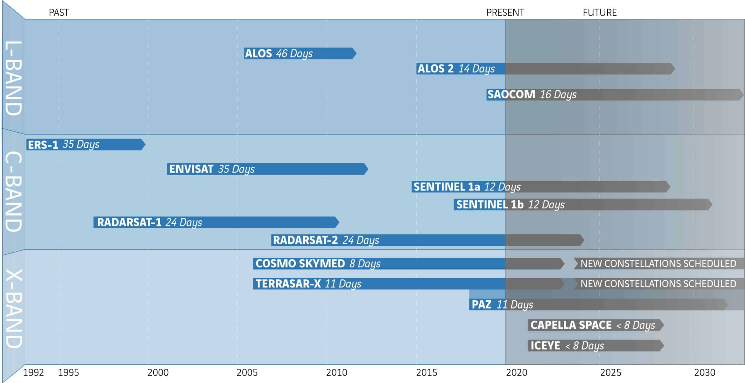
Space agencies (ESA, JAXA, NASA, among others) launched satellites with SAR sensors as early as 1990. Those satellites actively acquired images worldwide. Today, Sixense can download and process those images to precisely map and understand past ground and asset behaviour, enabling stakeholders to make informed decisions.
In the last decade, the availability of archives of High-Resolution satellite imagery in major cities has enabled the measurement of historical deformation in urban areas, with high precision and detail.
These retrospective studies are particularly suitable for projects in design phase, helping engineers to anticipate risks and identify vulnerable locations, for forensic analyses to understand past events, and for litigation protection by supplying solid, independent proof.
