Cyclops™ from Sixense – leaders in 3D Geodetic monitoring solutions
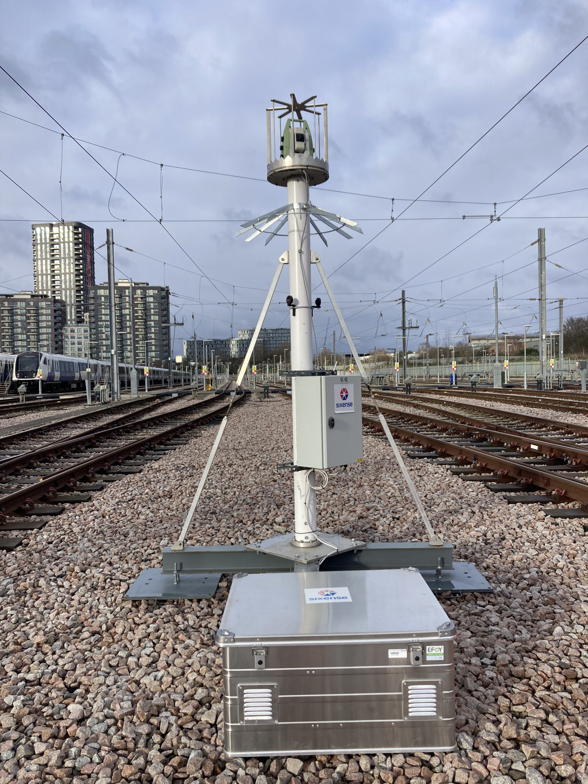
The Cyclops™ ATS (Automatic Total Station) system from Sixense is an industry-leading automated monitoring solution designed to continuously observe structural and surface movement in three dimensions. By controlling robotic and automatic total stations remotely, the system delivers sub-millimetric accuracy in measuring displacements across the X, Y and Z axes — making it ideal for monitoring everything from complex tunnels and bridges to roads, embankments and high-rise buildings.

What sets Cyclops™ apart is its versatility and robustness – whether deployed as a standalone station or networked in group of instruments, with prisms or prism-free, mobile or fixed, the system is able to adapt to project requirements and environmental constraints. It is equally effective in unstable zones and environments where reference prisms may shift — thanks to its ability to group multiple stations and reference external controls to maintain guaranteed accuracy.
Cyclops™ excels in real-world infrastructure projects. For example, during the major UK rail tunnel works for Crossrail, Sixense deployed numerous Cyclops ATS units to provide round-the-clock monitoring of tunnels, buildings, rail tracks and adjacent infrastructure — highlighting the system’s capability under demanding conditions.
Cyclops™ is provided by Sixense as a complete end-to-end service model — from design and installation through operation, data processing and reporting. During operation of Cyclops™ Sixense includes provisions for proactive maintenance, instrument calibrations, servicing and data quality assurance to ensure that the output is not just accurate but actionable.
For clients who manage high-value assets or complex construction project where settlement, convergence or deformation could pose major risks, Cyclops offers peace of mind through reliable, measurable control. With over 2,000 installations worldwide and more than 24 years of experience, Cyclops remains a go-to standard in automated topographic monitoring.
