
Ensuring the safe performance of highway infrastructure.
Road and highway infrastructure make crucial contributions to the economic and developmental growth of our society. They are of crucial importance to UK industry, not to mention the fact that they are the pillars of most of our day-to-day activities.
Roads provide us with access to employment, social, health and education services and stimulate economic and social development. For these reasons, road infrastructure is one of the most important of all public assets.
Whether it’s for existing infrastructure or new road developments or modifications, Sixense are able to deploy numerous solutions that can ensure the ongoing safety of highway assets either during construction, or accurately and efficiently record your highway’s inventory and condition.
We assist road operators and highways agencies to ensure the optimal level of service from their infrastructure.
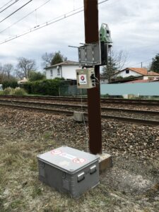
Sixense design, supply, install, operate and maintain custom monitoring systems to measure the impact on existing road networks from adjacent development or on new road networks during their construction, as well as long term structural health monitoring systems.
We provide solutions that enable Highways Asset owners the opportunity to understand the structural integrity and condition of their assets.
We provide monitoring solutions that record geotechnical behaviour, structural movement, and environmental impact.
We are able to deploy monitoring solutions that range form simple manual survey techniques, such as precise levelling, crack monitoring or geotechnical instrumentation in groundworks, through to fully automated site based solutions comprising Cyclops ATS systems and datalogged structural and geotechnical instrumentation.
We are also able to offer our in-house Atlas InSAR monitoring solution, capable of undertaking precise and efficient measurements of entire motorway and road networks, incorporating geospatial data acquired from satellites.
Mapping
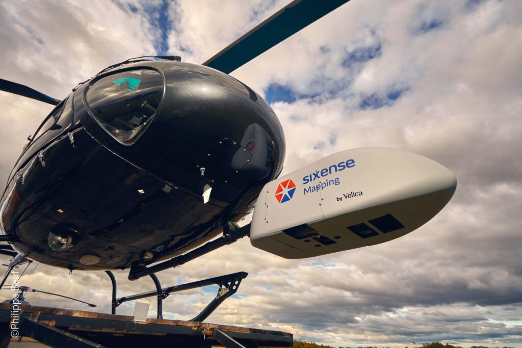
Working with our sister company, Sixense Helimap, we are able to undertake high precision LiDAR and photogrammetric data acquisition and processing services.
We use helicopters, drones, ultralights and terrestrial vehicles to undertake high precision surveys of road networks, safely and efficiently.
We undertake –
• Highway corridor / Road network mapping
• Mapping of complex and inaccessible areas
• High precision / resolution (1-10 cm)
• Thermal / Near Infrared Reflectance / Oblique / Panoramic imaging
Our expertise allows us to deploy rapidly and produce high-precision data for small to medium areas.