Geoscope monitoring software is used to manage, store and visualise manual and automatic monitoring data received from instrumentation and surveys completed on your work site.
It is a decision-making aid that enables you to anticipate and manage geotechnical, environmental and structural risks, allowing you to integrate data of all types derived from various sources and in several formats, notably provided by third-party services.
Real time data management of your construction sites and surroundings
Geoscope Monitoring Software is the information hub of every project we manage.
Its data management is tailored to suit our clients’ specific requirements.
The platform is particularly well-suited to projects where different types of data is being consolidated for analysis.


Whatever the size of your project, Geoscope is a scalable solution that is flexible enough to evolve with the expansion of your site and it’s operations.
The 200+ installations performed every year range from minor projects with less than 100 points of data, to sites where more than two million data values are imported every day.
All data is processed to deliver reliable alarm(s) and ready-to-use information.
Main features
- Real-time data processing
Geoscope monitoring software processes real time monitoring data using a powerful and versatile data-reduction engine. Integrating any type of data (automatic sensors, manual readings, environmental instrumentation, total stations, etc.), Geoscope provides advanced data analysis and visualisation for simple or complex structures.
- Dynamic integration of information from third parties
With the possibility to integrate data whatever the source or format is, Geoscope can manage data from existing monitoring systems deployed by third parties : TBM, Roadheader, Construction Site Progress, Photos, Inspections, Reports, CCTV, etc.
- Far–reaching cross-data alarm management
Advanced automatic alarm systems can be configured, permitting real-time alarms and enabling detailed and timely analysis of your project’s critical parameters.
- Specific interfaces
Each user has specific information requirements and needs. Common features are made available to all users, whilst specific interfaces can be configured to individual users’ needs to provide them with the most relevant information.
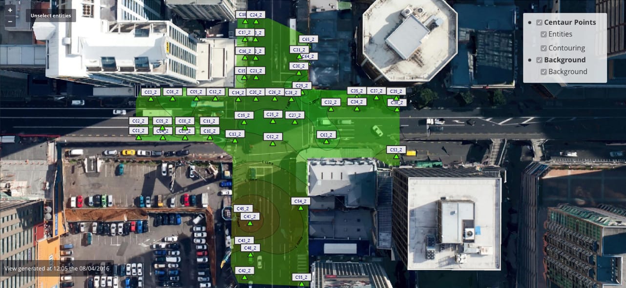
- Animated contour lines and 3D displacements
Geoscope provides a clear and user-friendly interface providing simple interpretation of geotechnical and structural behaviour.
- Cloud, desktop and mobile solutions
In addition to the classic desktop configuration, our mobile version of Geoscope makes your data readily available at any time & any place on your smartphone or tablet.
Use cases
Geoscope Monitoring Software is an open data-to-information system for technical risk management in civil engineering for all projects and assets concerned with geotechnical, structural or environmental risk management.
