ATLAS InSAR (Interferometric Synthetic Aperture Radar) satellite monitoring studies provide regular updates of ground and structural movement during the construction, operation and maintenance phase of any project.
From weekly to monthly, quarterly or yearly, the frequency of ground motion measurement can be adapted to the criticality of project phases and specific requirements, and can be readjusted at any time.
ATLAS InSAR provides customized services , from rapid bulletins providing a quick overview of the latest movements to comprehensive studies that indicate milimetric deformations associated with tunneling progress.
ATLAS InSAR is a robust, efficient and cost-effective monitoring solution to minimize and mitigate geotechnical risks.
Measuring ground motion from space
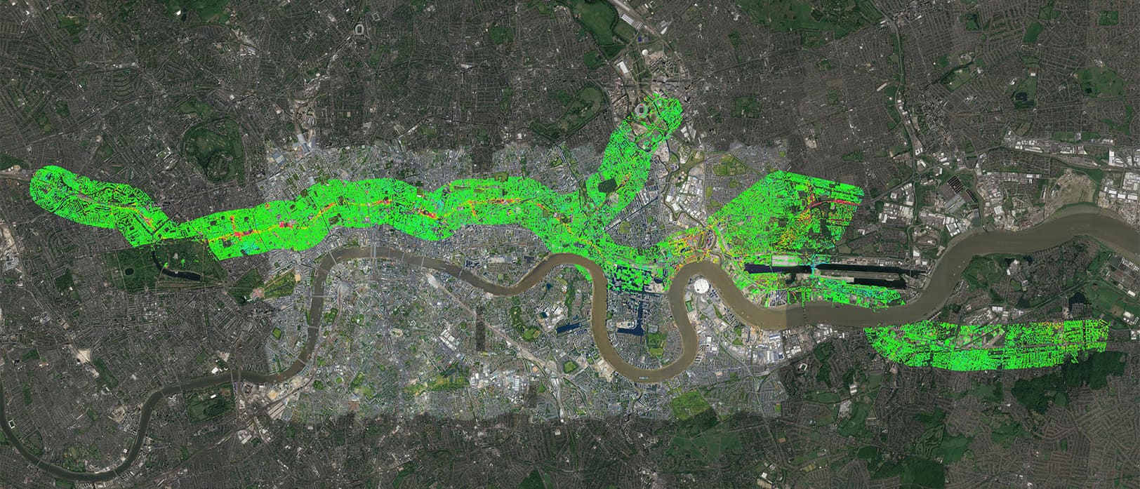
Using InSAR (Interferometric Synthetic Aperture Radar) technology, the ATLAS satellite solution allows for millimetric-precision measurements of ground, structures and construction sites.
Measurements obtained from satellite cover vast areas without any ground based intervention.
InSAR can provide a detailed analysis of the deformation of the terrain, which could be due to works carried out on it or other such events, allowing an understanding of the change to the impacted area.

Our ATLAS InSAR advanced processing chain can work with any current Satellite SAR Images.
Sixense teams can task SAR Satellites to acquire images over any area every few days to develop customized monitoring programs designed to provide ground and asset motion information.
Different Satellites can be tasked depending on site and motion characteristics.
ATLAS InSAR can work with X, C or L band to ensure the most appropriate data is used for each project.
New constellations are being launched, and very soon daily imagery will be available for real-time satellite monitoring programs at a fraction of the cost of traditional monitoring.
Monitor impact of construction works: drawing exact settlement contours
ATLAS InSAR monitoring can be applied during the construction phase of any project, providing millions of measurement points with millimetric precision.
The area covered are more often than not much larger than the defined Zone Of Interest, thus ATLAS services are a perfect tool to settle subsidence claims and complement other ‘in-situ’ instrumentation solutions.

Monitor tunneling activities: ground settlement due to volume loss
ATLAS InSAR monitoring is particularly suited to monitoring ground surface displacement resulting from tunneling activities and to measure it’s impact on existing buildings and infrastructure.
During tunneling, InSAR ATLAS monitoring solutions can be used to monitor ground settlement due to volume loss, verify surveying reference points and map any widening of the settlement outside the calculated ZOI.
Early warning tool : detect precursor motion to landslide and slope failures
ATLAS InSAR monitoring is an efficient tool to detect pre-cursor motion to landslides, slope failures along large areas such as highways, railways or pipelines and remote and critical infrastructure such as mines, tailing dams and bridges.
Non-linear motion, or motion acceleration, can be identified, enabling the implementation of early-stage mitigation interventions.
Long term smart maintenance
ATLAS InSAR Monitoring is the perfect tool to help develop and optimize new or existing long term maintenance programs.
It provides cost effective measurements and wide area coverage to assess structural health and detect motion likely to cause damage to infrastructure.
Risk Reduction in Mining and tailings dam
ATLAS InSAR Monitoring permits customized monitoring programs to support mining activity.
The solution can monitor motion of both underground and open pit mines and be used to ensure the stability of key infrastructures such as tailing dams, waste dumps and access roads.
