Sixense can provide conventional geophysical survey services and use our expertise in geology and applied geophysics to advise you on:
- Optimising your projects through subsoil visualisation
- Ensure the security of people and property
- Characterising the subsoil in urban, rural, mountainous, coastal, river and other environments that are not easily accessible
Clear answers to your soil-related issues
More than 25 years of experience supporting and facilitating your projects
Our multidisciplinary team offers more than 20 methods and technologies, backed up by sound advice, to identify the best-possible solution to your environmental, geotechnical and structural issues.
Our experts hold the largest number of AGAP quality approvals in the profession (www.agapqualite.org), providing our clients with valuable assurance regarding the sophistication and effectiveness of the methods we use and the quality and reliability of the services we provide.
An international team
Throughout its history, our team has been able to capitalise on a large volume of feedback from projects in France and abroad.
Our SIXENSE branches in more than 20 countries provide you with expert support worldwide.
What sets us apart
The size of our team as well as our international locations offer a speed of intervention and execution that is unique on the market.
We start with your problems and propose the appropriate methodology.
Thanks to the diversity of our expertise, our specialists will be able to provide you with the elements you need to understand your subsoil and the risks associated with it.

Conventional geophysics applications
Cavity (void) detection
Natural or anthropogenic cavity (void) detection by the most suitable geophysical method from the surface and in borehole.
Ground dynamic parameters
In borehole or Surface seismic measurement to obtain Vs30, VS, Vp and the dynamic elastic modulae of the subsurface such as Poisson’s ratio, Young’s modulus & Shear Modulus.
Geological model
Application of 2D or 3D geophysical methods to enrich an existing ground model (constructed by geotechnical parameters) with continuous data taking into account the heterogeneities of the subsurface.
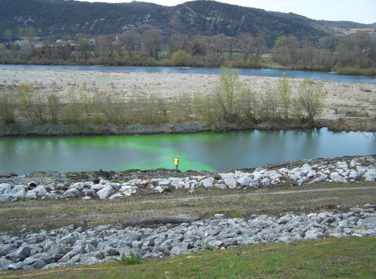
Water leakage detection
Implementation of geophysical tracing solutions to detect underground water circulation and water leakage.
Hydrogeophysics
Upgrading of structural geology model (fault, position of stratigraphic layers, etc.) using geophysical methods (2D/3D) to detect and to optimise subsurface aquifers exploitation.
Diagnosis of earthworks (excavation and filling)
Application of geophysical imaging adapted to the problem (high performing, monitoring, etc.) to assess the geometry of the structure and its current condition.
Detection of Buried objects (structures & archaeological mapping)
In borehole or surface geophysical methods to detect buried structures, foundations, tanks, etc.
Ground improvement
Geophysical measurement before and after injection process for a qualitative and quantitative evaluation of its effect.